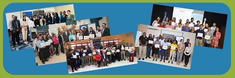
by Carmen Calle | Nov 7, 2023 | Barbados, Capacity Development, Caribbean, Deforestation, Drought and Fire, Ecosystem Management, English, Events, Guyana, Trinidad and Tobago, Uncategorized, User engagement
Since its establishment in 2005, SERVIR Global has collaborated with numerous countries worldwide to promote the use of satellite and geospatial information in decision-making to strengthen weather and climate resilience, agriculture for food security, water security,...
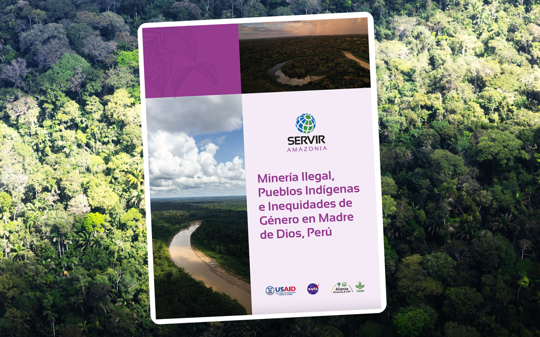
by Carmen Calle | Oct 6, 2023 | Deforestation, English, Peru, Publications
The SERVIR-Amazonia Program, in collaboration with its local partner in Peru, Conservación Amazónica – ACCA, has conducted a study to identify, understand, and explain the roles, weaknesses, and opportunities of men and women in the Madre de Dios region, as well...
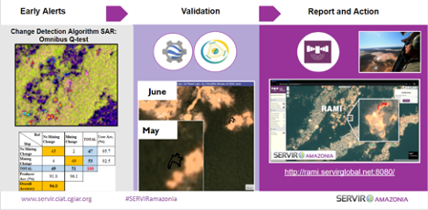
by SERVIR Team | May 11, 2022 | Deforestation, English, Peru, Spanish, Stakeholder engagement
In a recent blog on the SERVIR Global Website, the co-developing service team of the Radar Mining Monitoring tool RAMI, composed by the Peruvian NGO Conservación Amazónica (ACCA), the Ministry of Environment and the Spatial Informatics Group (SIG), describes how...
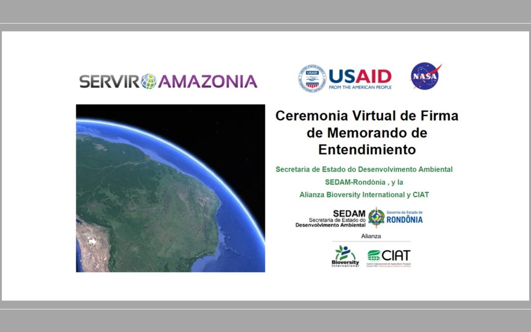
by Simone Staiger | Mar 7, 2022 | Brazil, Capacity Development, Deforestation, Drought and Fire, English, Portuguese, Services, Spanish, Stakeholder engagement
With the participation of USAID and NASA a new Memorandum of Understanding has been signed between the State Secretariat for Environmental Development (SEDAM-Rondônia) , Brazil, and the Alliance of Bioversity International and the International Center for Tropical...
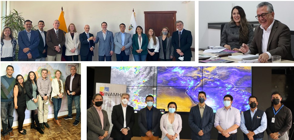
by SERVIR Team | Dec 7, 2021 | Deforestation, Drought and Fire, Ecuador, English, Portuguese, Services, Spanish
Autor: José Leandro Fernandes Un nuevo convenio firmado y el gusto de definir próximos pasos de colaboración de manera presencial con socios en Ecuador es el balance de la visita hecha a este país del 15 al 18 de noviembre de 2021, por una delegación compuesta por...
by SERVIR Team | Nov 12, 2021 | APN, Brazil, Capacity Development, Deforestation, Ecosystem Management, Ecuador, English, Portuguese, Services, Spanish
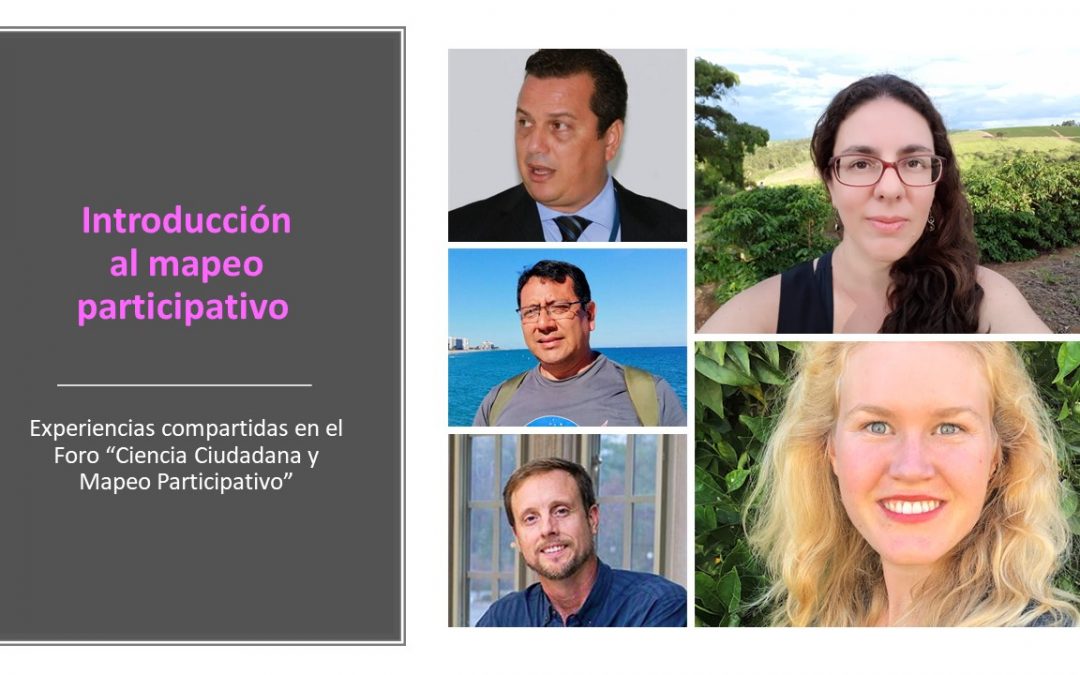
Ver los resúmenes anteriores: Sesión 1: “Voluntarios Digitales” Sesión 2: “Tecnología geoespacial y pueblos indígenas” Sesión 3: “Herramientas para agilizar la toma de decisión sobre el manejo territorial” Introducción al mapeo participativo Carolina de Carvalho...


