


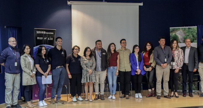
Ecuador – January 5, 2025 – Within the framework of the SERVIR Amazonia program, Fundación EcoCiencia highlighted its commitment to the use of geospatial technologies for environmental conservation and territorial management, participating in two significant events organized at the Yachay Tech University, in collaboration with local academic and government institutions.
Geo Explore Day: Geospatial technology in action
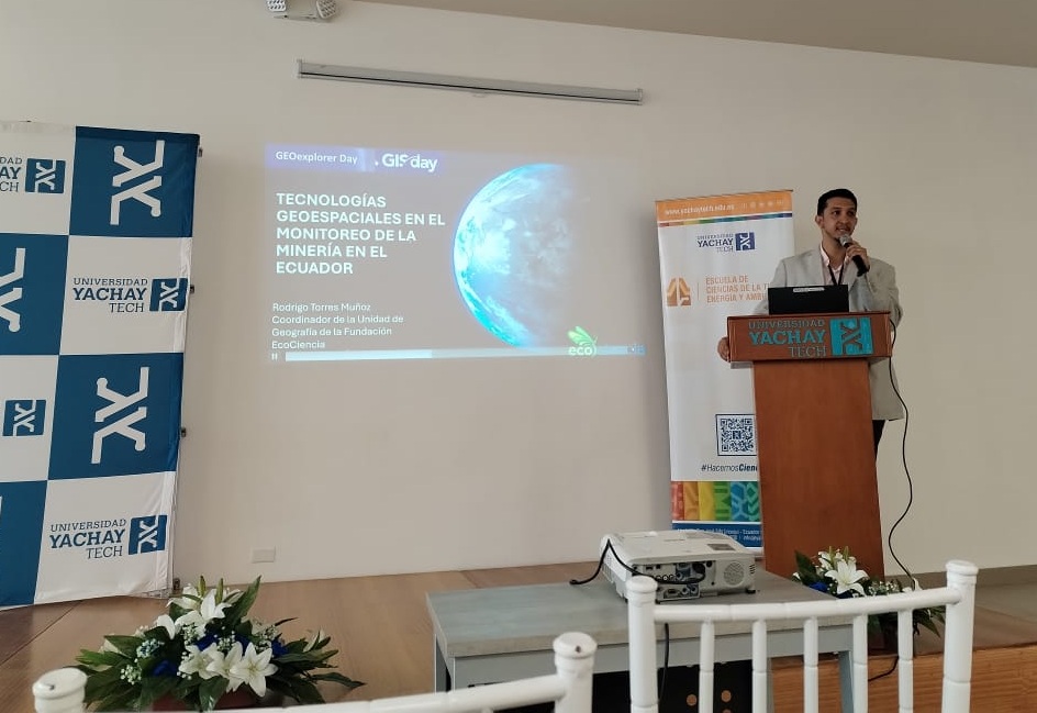
Rodrigo Torres at the Geo Explorer Day in Universidad de Yachay Tech.
During Geo Explore Day, Rodrigo Torres, representing Fundación EcoCiencia, presented the progress of the SERVIR Amazonia program and the impact of geospatial technologies in monitoring mining in Ecuador. The presentation highlighted the importance of using satellite data to identify and mitigate environmental impacts associated with mining activities, highlighting how these tools strengthen the sustainable management of Amazonian territories.
Dissemination of the vegetation height model and the INAMHI GEOGLOWS platform
Fundación EcoCiencia team at Universidad de las Fuerzas Armadas (ESPE).
In a second activity carried out together with the Technical University of the North and the Decentralized Autonomous Government (GAD) of Imbabura, EcoCiencia Foundation led the dissemination and evaluation of innovative tools for environmental and risk management, thanks to the participation of Lorena Caiza and Juseth Chancay.
Caiza presented the Vegetation Height Model with free data for Imbabura, highlighting its potential for the identification of vegetation types by relating it to ecosystem data and environmental management in the region. For his part, Chancay spoke about the INAMHI GEOGLOWS Platform, a key tool for monitoring extreme hydrometeorological events. Both presentations were aligned with the following objectives:
- Disseminate the vegetation height model, promoting its evaluation and application in environmental management.
- Present the INAMHI GEOGLOWS platform as a complementary tool for monitoring hydrometeorological risks.
- Identify possible applications of these technologies in strategic institutions.
In parallel, Lorena Caiza facilitated the workshop entitled “Innovations in Remote Sensing and GIS: Tools for Sustainable Development” at the University of the Armed Forces (ESPE). The workshop sought to identify practical applications of geospatial sciences in real cases, highlighting their impact on decision-making to: Prevent forest fires; Reduce carbon emissions; and, Protect key carbon sinks.
Lorena Caiza at a workshop in Universidad de Yachay Tech.
In addition, the importance of inspiring and educating new generations was emphasized, strengthening adaptive planning and the resilience of ecosystems and communities. This approach contributes to the conservation of vital ecosystem services, such as water regulation and biodiversity, in the face of increasing climate stress.
These activities reflect Fundación EcoCiencia’s collaborative approach to strengthening local capacities, improving collaborative work with academia, and promoting innovative technologies to address environmental challenges.