Peruvian government institutions recently requested the SERVIR Amazonia program to improve its capabilities in processing satellite images for monitoring changes in land cover. In this sense, the Program offered training on the Google Earth Engine platform (GEE), an open source tool that allows accessing and processing large amounts of data in the cloud quickly and efficiently.
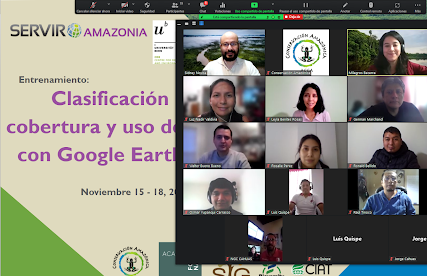
In November 2021, the virtual training “Classification of land cover and use with Google Earth Engine” was held, organized by Conservación Amazónica – ACCA, within the framework of the SERVIR-Amazonia program and with the support of the Centre for Development and Environment of the University of Bern and the Wyss Academy for Nature. The training presented the general theoretical-practical bases of the GEE cloud processing tool, with special emphasis on land cover classification, including Supervised and Unsupervised classification methodologies.
This event was organized by Conservación Amazónica – ACCA, within the framework of the SERVIR-Amazonia program and with the support of the Centre for Development and Environment of the University of Bern and the Wyss Academy for Nature. The training presented the general theoretical-practical bases of the Google Earth Engine (GEE) cloud processing tool, with special emphasis on land cover classification, including Supervised and Unsupervised classification methodologies.
GEE is a geospatial analysis tool based on cloud computing that allows access to a wide catalog of geospatial data (example satellite images from satellites such as constellations such as Landsat-8, Sentinel-2, Planet, among others), as well as processing large amounts of data in order to perform analyzes on a regional and national scale, quickly and efficiently.
Conservación Amazónica-ACCA together with the National Forest Conservation Program for Climate Change (PNCBMCC), currently develops the Illegal Gold Mining monitoring service RAMI – Radar Mining Monitoring, which generates early alerts related to mining activities and this training increased the knowledge of this important stakeholder in the Cloud Computing tool and access to data catalogues in GEE. “ […] it is a powerful tool that surpasses licensed software because it can be used on any PC. The difficulty is to have a greater knowledge of Javascript but that can be overcome because there is lots in the GEE Library, and many applications can be generated”, says a participant from PNCBMCC, MINAM.
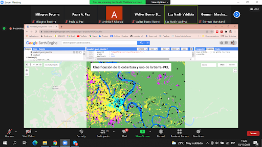
Figure 1. Demonstration made by trainers using Landsat 8 (Supervised Classification)
The training had 16 participants in total, representatives of the offices of the Ministry of the Environment and the Ministry of Agriculture, from the General Directorate of Territorial Planning and Integrated Management of Natural Resources (DGOTGIRN-MINAM), el Servicio Nacional de Áreas Naturales Protegidas (SERNANP), Servicio Nacional Forestal y de Fauna Silvestre (SERFOR), and the National Program for the Conservation of Forests for Climate Change (PNCBMCC). The knowledge imparted during the training will lay the foundation for the discussion of potential geospatial services. The recorded sessions are available in the following link: Folder. Trainers where: Kaspar Hurni, Lukas Würsch (Centre for Development and Environment at University of Bern), Lucio Villa (ACCA), Andréa Nicolau (SIG) y Paula Paz (Alianza Bioversity-CIAT)
On the last day of the training the participants presented the initial results of their classification of land cover using Google Earth Engine This example indicates a supervised classification of a free cloud mosaic of 2020 using the dataset of Landsat 8. The map allows to distinguish Forest Land, Cropland, Grassland, Wetland, Settlements and other land uses.
Authors of this blog