


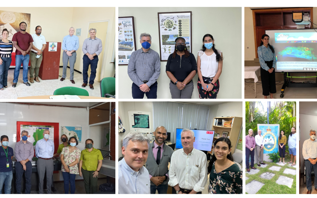
SERVIR-Amazonia began the second quarter of 2022 by visiting five Caribbean countries, expanding the geographic impact of its Program. The objective of the activity which is funded by the United States Agency for International Development (USAID) for a 2-years period (2022 and 2023) is to provide training and seek technical commitment with governments, universities, research institutions and NGOs to advance environmental decision making based on geospatial technology, information and data.
A delegation from the SERVIR-Amazonia Program visited Barbados (March 28-30, 2022), Suriname (March 29 – April 1, 2022), Trinidad and Tobago (April 11-13, 2022) and The Bahamas (May 9 and 10, 2022), contacting more than 30 organizations. “Our aim has been to promote inter-institutional collaboration and interaction between interested parties, and strengthen the necessary capacities to develop sustainable geospatial applications” explained Carlos Gasco, Director of the SERVIR-Amazon Program.
Each visit provided an opportunity to present the Program and its unique approach to co-developing geospatial services, as well as to understand the priorities and institutional needs regarding the use of Geographic Information Systems (GIS) and Earth Observation Satellites (EOS). The visits also identified local organizations as collaborators and coordinators of future Program activities in the Caribbean.
“It has been very encouraging to receive so much interest and such a positive reaction from the different organizations that we have visited, and with whom we plan to hold more detailed needs assessment workshops. Those events are expected to attract more actors in each country and to get into more details about a training agenda that we want to design and deliver” highlights Paula Paz, Engagement Coordinator for the Caribbean.

Meeting with the University of Trinidad and Tobago.

Meeting with the Environmental Management Authority in Trinidad and Tobago.
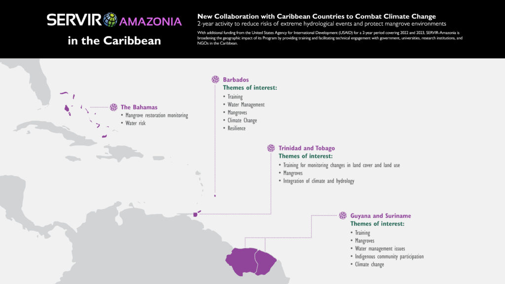
“Our activity will address two topics: Mangroves (Monitoring of land cover changes and land use change); and Flood Monitoring integrating climate and hydrological data. On both topics our aim is to strengthen the resilience to natural disasters of local communities – including the participation of indigenous and Maroon communities.” said José Leandro Fernandes, User Engagement Lead, SERVIR-Amazonia Program. Fernandes also pointed out that some institutions already have strong capacities and can receive more specialized training (Python programming and coding), while others are just beginning to use GIS applications in their daily activities. Therefore, it is clear that trainers need to be trained in order to give sustainability to the cogeneration and adoption of geospatial services.
After this first contact, the SERVIR-Amazonia Program is now in a better position to identify the solutions for the user institutions in each country.
In addition, a survey of uses, capacities and needs related to geospatial technologies has been developed and sent to the countries visited during this tour. The results will help build the capacity building strategy and work plan of the Program that is expected to be implemented in the Caribbean in the coming months.