SERVIR Amazonia
SERVIR Amazonia
  • Home
  • About
    • Program
    • Team
    • Partners
    • SERVIR Global
  • Caribbean
  • Services
    • Service Areas
    • Service Catalogue
  • Users & Networks
    • Social Inclusion
    • Academic Partner Network
  • Resources
    • Data Catalogue
    • Publications
    • MEL Dashboard
  • News
  • Technical Assistance
  • English
    • Español
    • Português
Select Page
Restoring soils in continental Ecuador, now a more feasible goal with new Digital Chemical Fertility Map

Restoring soils in continental Ecuador, now a more feasible goal with new Digital Chemical Fertility Map

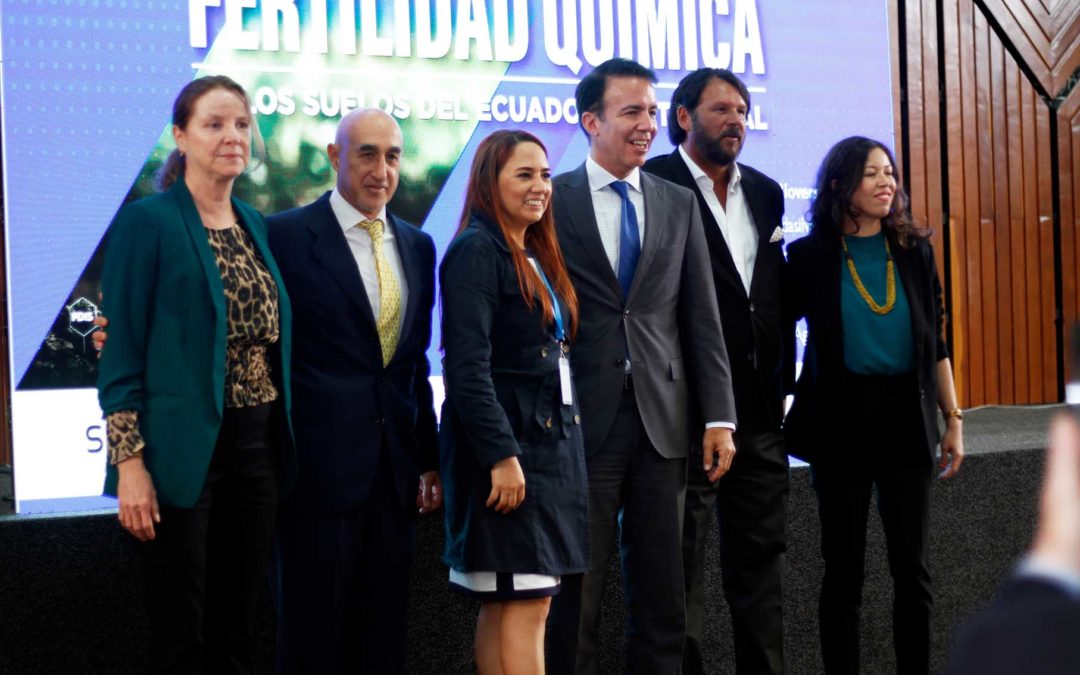
by SERVIR Team | Aug 31, 2022 | Ecuador, English

50% of Ecuador’s soils are being degraded. This situation demands special attention, as it leads to the reduction of water sources and increases vulnerability to climatic events in agriculture, which puts food security at risk. Faced with this challenge, a...
Launching of a new geospatial service to monitor and protect mangroves in Guyana

Launching of a new geospatial service to monitor and protect mangroves in Guyana

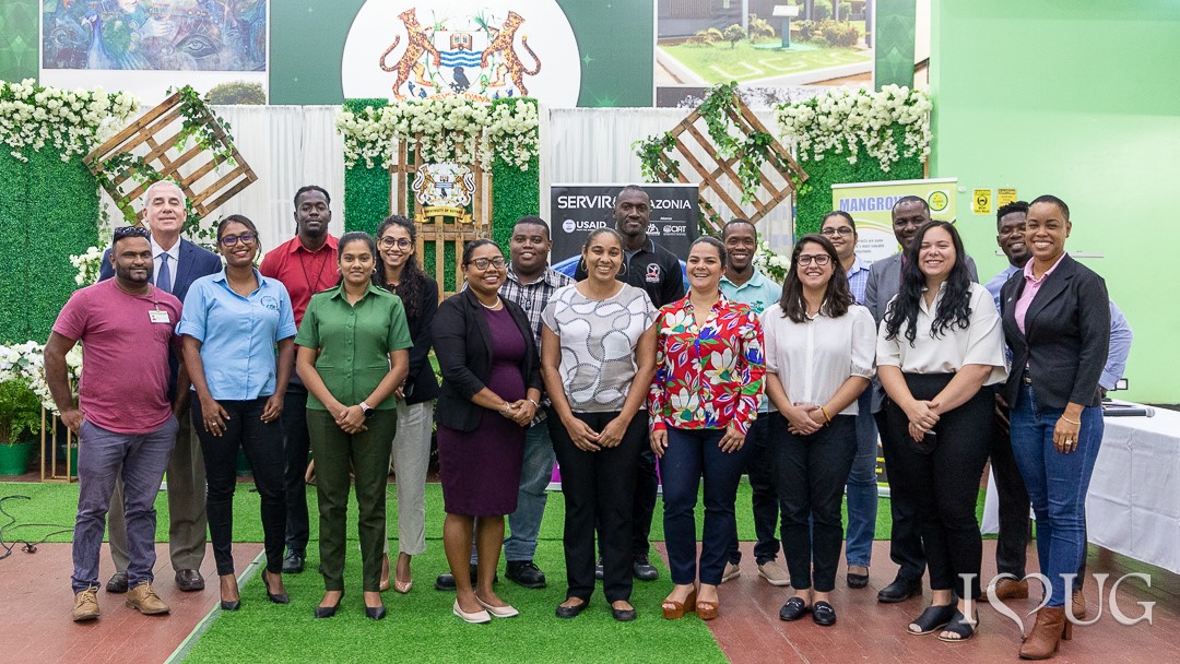
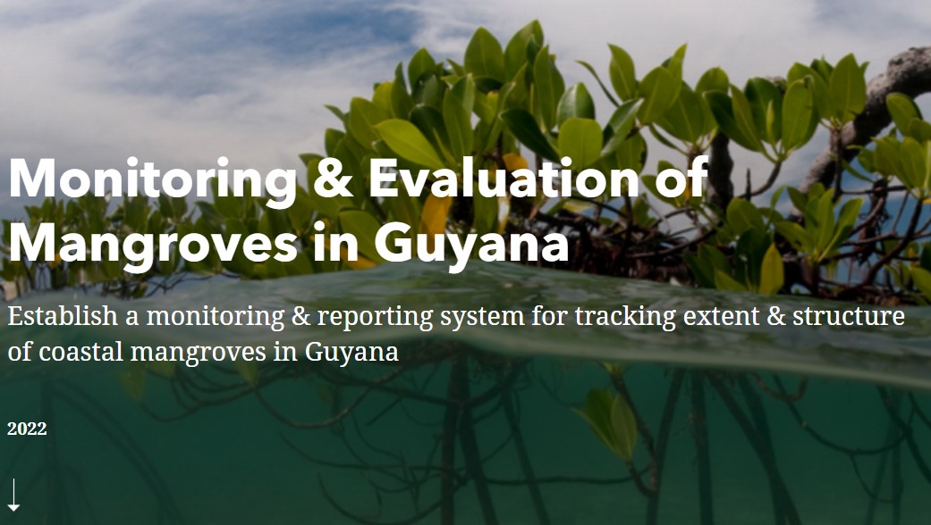
by SERVIR Team | Aug 18, 2022 | English, Guyana

In Guyana, mangroves are crucial for wave attenuation, and their intricate root systems help in sediment binding. As a result, they lower erosion rates while also acting as a key barrier during severe storms. Mangroves play a vital role in carbon capture and they...
Monitoring & Evaluation of Mangroves in Guyana

Monitoring & Evaluation of Mangroves in Guyana

by SERVIR Team | Aug 10, 2022 | English, Mangroves Monitoring

Fire Forecasts July-September 2022 (Western Amazon)

Fire Forecasts July-September 2022 (Western Amazon)

by SERVIR Team | Aug 10, 2022 | Brazil, Drought and Fire, English, Portuguese, Spanish

July-September 2022 climate forecast points to a mild to slightly above normal fire season in western Amazon, similar to 2021

July-September 2022 climate forecast points to a mild to slightly above normal fire season in western Amazon, similar to 2021

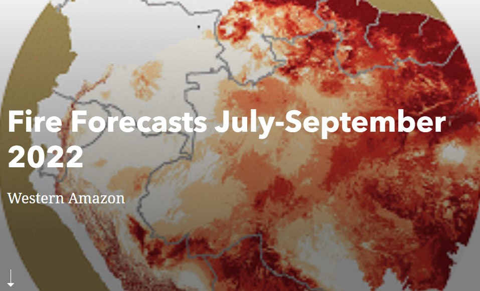
by SERVIR Team | Aug 4, 2022 | English

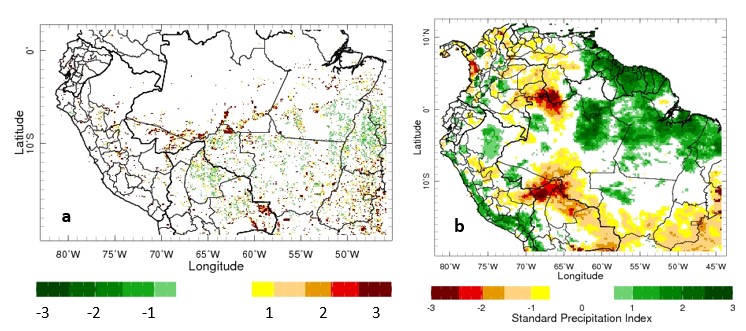
Fires in the Amazon are the result of human activities that (usually) begin with slash and burn practices to clear the land for the introduction of agro-pastoral activities. For most part, fires occur over non-forest landscapes but can escape to standing forest edges...
Satellite Monitoring Offers New Hope for Controlling Fires  to Curb Environmental Damage in the Amazon

Satellite Monitoring Offers New Hope for Controlling Fires to Curb Environmental Damage in the Amazon

by SERVIR Team | Jul 28, 2022 | English

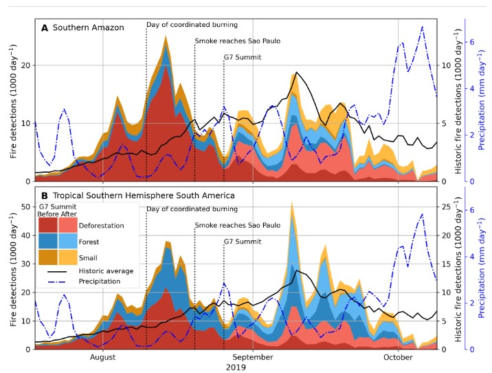
A new approach for using satellite data to track and classify fires in and around the Amazon represents a major breakthrough in responding to the hundreds or thousands of fires occurring each day at the peak of the region’s fire season. Because these fires are a major...
« Older Entries
Next Entries »

Recent Posts

  • Strengthening strategic alliances with the Academy to promote environmental and territorial management in Ecuador
  • SERVIR-Amazonia and EcoCiencia analyze the use of INAMHI-GEOGLOWS to maximize their impact
  • SAGE 2024: SERVIR Amazonia Strengthens Cohesion and Sustainability in the Global Network
  • SERVIR Amazonia Showcases Innovative Geospatial Solutions at Geo for Good Mini Summit 2024
  • A key platform for weather and fire forecasting in Ecuador

The information provided on this Web site is not official U.S. Government information and does not represent the views or positions of the U.S. Agency for International Development or the U.S. Government.

  • Facebook
  • Twitter
  • Youtube
  • Linkedin
SERVIR-Amazonia Copyright © 2022 The Alliance of Bioversity International and CIAT