


A new approach for using satellite data to track and classify fires in and around the Amazon represents a major breakthrough in responding to the hundreds or thousands of fires occurring each day at the peak of the region’s fire season. Because these fires are a major source of carbon emissions, while also contributing to biodiversity loss and air pollution, a sharp uptick in burning during 2019 garnered global concern.
As described in a study published today by the journal Science Advances, the new approach resulted from a research collaboration among scientists at Cardiff University, NASA, the National Oceanic and Atmospheric Administration (NOAA), and the University of California-Irvine.
“Our approach tracks individual fires in near real time and also categorizes each fire into one of four different types,” said Niels Andela, lead author of the study and formerly a professor at the UK’s Cardiff University who is now a Senior Scientist at BeZero Carbon. “This information, updated daily, offers valuable guidance to those responsible for responding to fires in the region; it helps them decide which fires to prioritize in a fire emergency. The information also helps us better understand the carbon emissions and ecosystem impacts that result from burning in the Amazon.”
All four fire types are started by humans, but each has its own unique signature in terms of fire intensity, behavior, and carbon emissions:
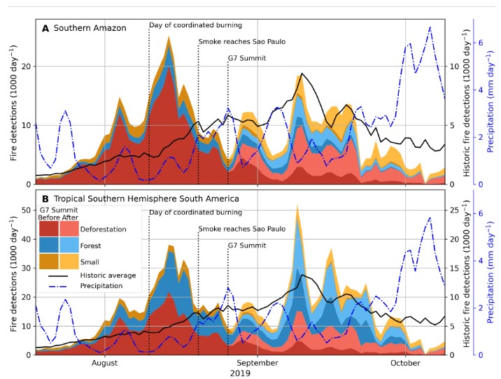
1. Deforestation – After forest clearing, stumps and roots are burned to make way for pastures or croplands. These fires have a large impact on carbon emissions from the Amazon, because the grasses and crops that replace tropical rainforest store less carbon.
2. Forest – Understory forest fires occur when deforestation or agricultural fires spread into nearby forests, sometimes burning unchecked for months. Since Amazon forests are quite vulnerable to fires, these low-intensity fires kill trees and are a leading cause of forest degradation.
3. Agricultural – On land already cleared for pastures or crops, fire is commonly used for land management or to prepare for the next planting.
4. Savanna – In the natural savannas or grasslands found within the Amazon, fire has played an important role over many centuries in the evolution of plant and animal species.
Although fire detections from satellites have been used by national and state government agencies, conservation groups, and scientists to monitor fires in the Amazon for more than two decades, the resulting data have been used only to locate fires, not to track their spread or to determine what types of fires are burning. Separating deforestation from forest fires, for example, has proved especially difficult. To overcome this limitation, the study authors used data from the most advanced fire monitoring instruments – the Visible Infrared Imaging Suite (VIIRS) on the Suomi-NPP and NOAA-20 satellites. VIIRS fire detections have higher spatial resolution and better daily coverage, making it possible to track the growth of individual fires over time.
“By classifying fires according to the four types, we confirmed that deforestation accounted for 40% of all satellite fire detections and the majority of carbon emissions from fires in the Amazon during 2019,” said NASA Scientist and study co-author Douglas Morton. “We also identified more than 3,000 forest fires, some of which burned hundreds of thousands of hectares during the dry season. In total, these fires damaged more forest than deforestation for agricultural expansion. A key benefit of our monitoring approach is that it estimates carbon emissions by fire type for each fire. This makes it possible to focus on containing the fires that contribute the most to carbon emissions while these fires are still relatively small.” The research team is working closely with state environmental agencies in the Brazilian Amazon to update and improve the data product to support regional fire management.
Data provided by the new satellite monitoring approach are released to the public through the Amazon Dashboard. This is an interactive platform designed to provide daily updates on new fires and fires in protected areas. It was developed with support from SERVIR, a partnership between NASA and the US Agency for International Development (USAID), which promotes the use of satellite data in regional decision-making. The international research team behind the Amazon Dashboard works with national and local partners to tailor the data and web interface for specific information needs, including rapid identification of fires in protected areas.
“Our inability to distinguish between types of fires in detecting them via satellite has seriously hindered efforts to suppress fires as well as to determine their impacts on ecosystems and air quality, said Brian Zutta, Science and Data Lead with SERVIR-Amazonia. “The task ahead is to ensure widespread application of the new approach for near real-time tracking and classification of Amazon fires through our strong national partnerships.”
About SERVIR-Amazonia
SERVIR-Amazonia is part of SERVIR Global, a joint development initiative between the National Aeronautics and Space Administration (NASA) and the United States Agency for International Development (USAID).