Inhibiting the advance of disturbances such as illegal logging, mining and agricultural activities in the Amazon rainforest requires an effective change monitoring to accomplishment of command and control measures. Although Brazil has several monitoring programs, the information is dispersed in different instances of public agencies and there are technological and bureaucratic barriers to make it available, which embarrass quick responses to environmental issues.
For the Geotechnologies team from the Institute of Forestry and Agriculture Management and Certification (Imaflora) the spatial data from these programs are especially needed for integrating the actions to Amazon protection and therefore the tools as Geoserver can help to improve the spatial analyzes of the public institutions, research centers and environmental organizations that work in Amazon region.
For the environmental sector, moving from the analog map to the digital one means being able to work with increasingly extensive landscapes and identify changes in the territories in almost real time. However, the use of digital and dynamic maps on the web requires specific servers, which can be a restriction on the sharing flow. Keeping this scenario in mind, SERVIR-Amazonia’s Hub partner Imaflora carried out a virtual training about the use of Geoserver aiming to help organizations that work with the Amazon protection to store, share and obtain spatial data through the internet or a local network.

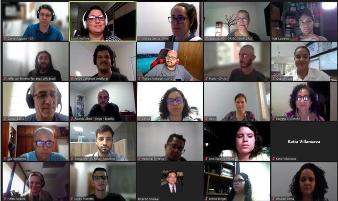
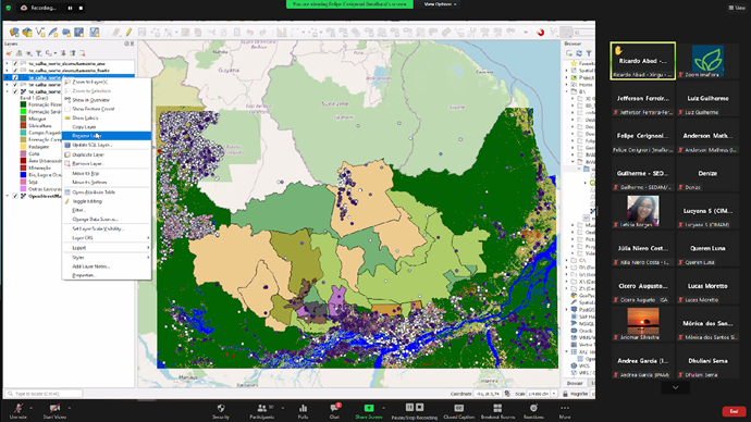
Anderson Cardoso, Information Technology analyst, and Felipe Cerignoni, Geotechnologies analyst, both from Imaflora, led the training for 31 participants in the use of Geoserver, including its integration with Geographic Information Systems, such as QGIS. The Geoserver interface and main functions were explored so that participants could add and manipulate different types of spatial files as well as configure them according to the appropriate styles for visual identity of their projects. The database of TerraOnTrack application – a tool developed by Imaflora with the support of SERVIR Amazônia that allows people at field to view spatial information in socio-environmental territories, collect information about disturbances in the forest and create alerts for some support institution- was used for the examples and practical exercises.

During the training, a part of the TerraOnTrack application database was used focusing on the region of Calha Norte, in Pará. Public dataset credits: Deforestation (Prodes-Amazônia-INPE, 2019); Fire outbreaks (Amazon Dashboard, 2020); Indigenous Land (FUNAI, 2019); Conservation Units (MMA, 2019), Rural Settlements (INCRA, 2019) and Base Map (Planet Lab Inc. mosaic 2020-10).
The training, which lasted 16 hours divided into three days with live classes and complementary exercises, was carried out and recorded on the Zoom platform, which enabled participants from different regions and institutions to join, such as: Pará State Environment and Sustainability Department (SEMAS-PA), National Institute for Space Research (INPE), SEDAM – Rondônia, FEMARH-Roraima, Acre Environment and Indigenous Policies Department (SEMAPI-AC), Life Center Institute (ICV) ), WRI Brazil, Amazon Environmental Research Institute (IPAM), National Center for Monitoring and Early Warning of Natural Disasters (Cemaden), Sema – Mato Grosso, EMBRAPA, Pro-Indian Commission of Acre (CPI-Acre), CENSIPAM, Women in GIS, Socio-Environmental Institute (ISA), Federal University of Acre (UFAC) and Federal University of Goiás (Lapig-UFG).
The main result was that the participants were able to understand how a digital map server can collaborate to improve the management and availability of spatial data, in addition to raising a discussion about data sharing between organizations. This is because structured, secure and agile access to relevant data is essential for day-to-day analysis and decision-making. One of the participants highlighted that, in times of political instability and recurrent blackouts in government repositories, technological resources such as those presented during the training can allow the “a safeguard mechanism in the access to public data already available”.
The course was finished with a reflection exercise on how free geospatial technologies can contribute to initiatives to public open data, including research data that are currently only found in theses and dissertations databases and in an unsuitable format for spatial analysis.


