


Mean high tides exceed land elevation by as much as 2 m along the Guyana coast. With rising sea levels due to climate change, the country expects more intensive flooding, saltwater intrusion and related problems throughout the coastal lowlands. Mangrove forests serve as barriers to ocean tides, building up soils and sediments and functioning as natural seawalls. They also protect the seawall infrastructure itself. The location and extent of these ecosystems frequently change due to coastal erosion, anthropogenic land conversion and changes in water quality and quantity in their watersheds. But Guyana and most other countries lack periodic and sustained monitoring and evaluation systems for their mangrove forests. A group of Guyana government agencies and NGOs are working to change that. They are working with the SERVIR-Amazonia initiative — a NASA and USAID program bringing Earth observation and geospatial technology to sustainable development — to provide Guyana with the most up-to-date information on the state of the mangroves along the country’s entire coast. The monitoring system will use satellite radar and optical imagery to monitor the extent, structure and changes in Guyana mangroves going forward.
Last week the University of Guyana (UoG) hosted 20 geographic information scientists, remote sensing specialists and mangrove experts in the first phase of a broader effort to develop a system for mangrove monitoring and evaluation. The meeting featured training in radar remote sensing by Dr. Marc Simard of NASA’s Jet Propulsion Laboratory. Marc has mapped mangrove forests throughout the world using Sentinel-1 radar imagery, data from the Shuttle Radar Topography Mission (SRTM) and other active and passive remote sensing platforms.
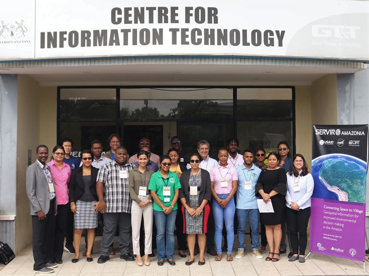
Participants pose for a group photo outside the University of Guyana’s Center for Information Technology
Training sessions included how to use radar imagery and existing data to map the extent and structure of mangrove forests on the coast. Participants learned how to use digital elevation models and extent maps to calculate mangrove tree height. The tree height maps are an important indicator of where trees reach their potential vertical growth limits. The height data was then used with estimates of tree size and wood density to estimate above-ground biomass of the mangrove forests. Guyana is interested in this kind of information to support its national forest and greenhouse gas inventories.
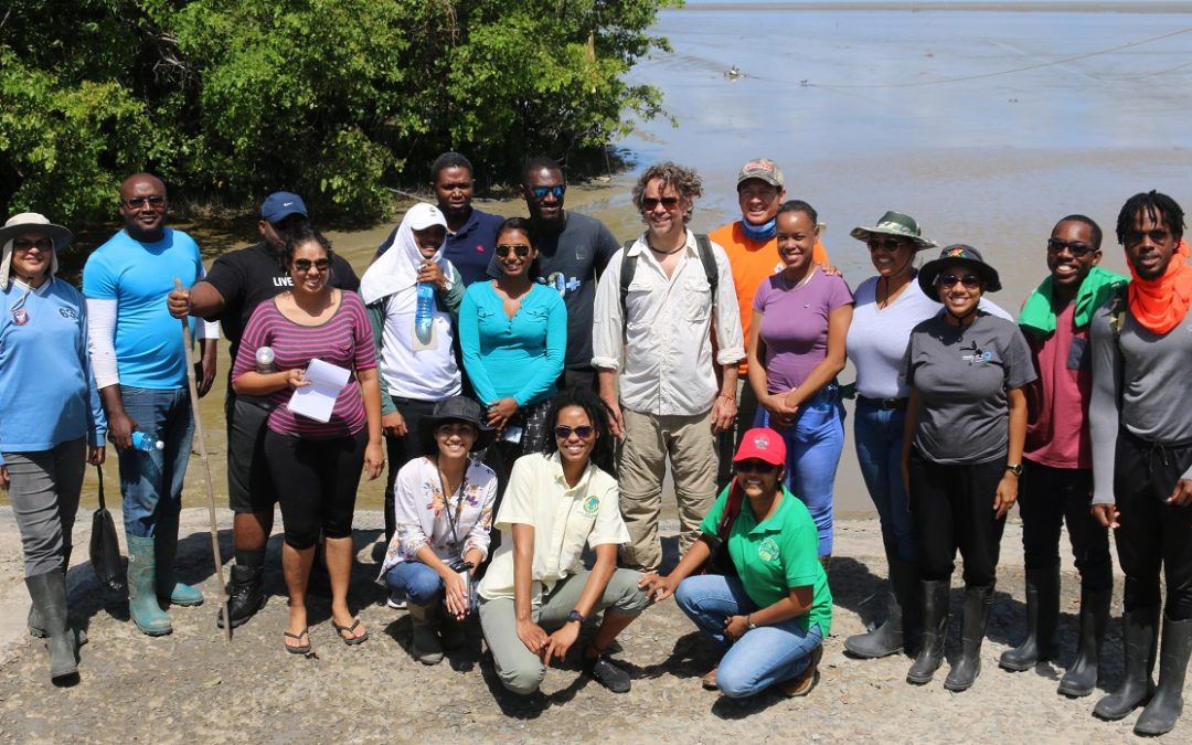
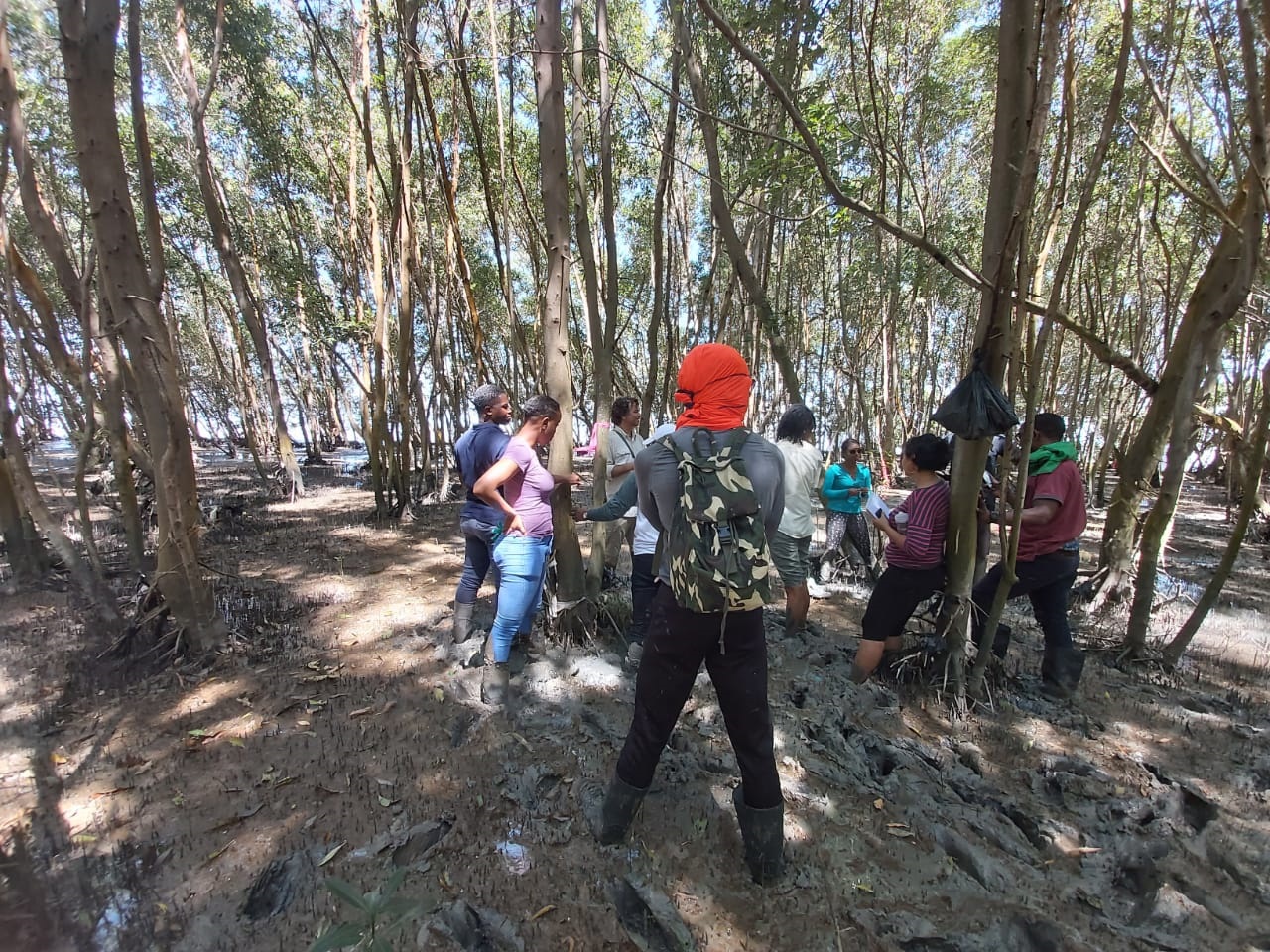
The meeting also included a field trip to mangrove forests near Georgetown, where participants learned how to establish plots for measuring tree height and biomass. The group visited natural mangrove forests, restoration plots that had been established in 2010 and areas that were deforested in years past. Workshop participants from the Guyana Forestry Commission (GFC) and the University of Guyana provided clinometers, laser range finders, measuring tape and other equipment for measuring tree heights and diameter at breast height (DBH) for the mangrove forest plots. Participants learned how to use the measured data in allometric equations for estimating above-ground biomass in the mangrove forest.
The newly formed mangrove monitoring and evaluation team will now take what they learned from the workshop and apply it to the task of setting up a remote sensing based system for Guyana.They are planning to build their system on a 2018 baseline study carried out by the National Agricultural Research and Extension Agency (NAREI), Conservation International (CI) and others. The first task will be to update the 2018 map to 2020, identifying any changes in mangrove extent over the last two years. Then the team will use the base map to make additional maps of tree height and biomass for mangroves along the entire coast of Guyana. The team also plans to write proposals to the Japanese Space Agency for acquiring L-band radar data, imagery that penetrates forest canopies to better characterize forest structure. The L-band data will be used by partner organizations for mangrove mapping and other uses throughout the country.
Workshop participants are planning several other activities in the coming months, including a “hackathon” in May of this year to develop the mangrove monitoring system. UoG Dean of the Faculty of Earth and Environmental Sciences and principal investigator on the project Dr. Temitope Oyedotun said the initiative will have positive benefits for the participating organizations well beyond the mangrove activity. “Our organizations now will have trained professionals who know how to acquire, pre-process and analyze radar data for any number of applications in environmental analysis and planning,” he said. Other participating Guyana organizations include the National Drainage and Irrigation Authority (NDIA), the Amerindian Peoples Association (APA), Conservation International (CI), World Wildlife Fund (WWF), the Hydrometeorological Service, the Environmental Protection Agency (EPA), the Ministry of Natural Resources, the Guyana Lands and Surveys Commission, the Department of Environment, Guyana Forestry Commission (GFC) , and the Ministry of Public Infrastructure – Sea and River Division. The group aims to make an impact alongside the larger effort to protect mangroves and the coastal lowlands from rising sea level, as well as other environmental challenges facing Guyana.
Author of this post
 Glenn Hyman (SIG),
Science and Data Lead,
SERVIR-Amazonia