In this session of the Global Landscape Forum GLF Amazonía: The Tipping Point on September 22, SERVIR-Amazonia and partners explored how advancements in geospatial and Earth Observation technology are enhancing forest monitoring, disaster forecasting and evidence-based decision-making in the Amazon biome. Drawing on novel innovations in remote sensing and satellite imagery, panelists discussed pathways towards effectively connecting ‘Space to Village’, scaling public and private investments to improve internet connectivity in isolated areas, and strengthening locally-led efforts to protect biodiversity and Indigenous territories via the use of geospatial technology.
Earth observations (EO) and geospatial decision-support systems play an increasingly critical role in reducing greenhouse gas emissions and impacts of climate change. These systems can provide solutions to development problems in the Amazon as they bring together remote communities and marginalized groups with data and information providers in governments, private sector and NGOs.
However, serious challenges remain to effectively reaching our goal of connecting Space to Village and scale up these innovations, such as: The effectiveness of geospatial data & information value chains, the capacity of national and sub-national actors in understanding, contributing to and using the latest technologies or the access to internet for local and often isolated communities.
Watch the SERVIR-Amazonia video
Download the session white paper
Juan Lucas Restrepo
Director General, Alliance of Bioversity International and the International Center for Tropical Agriculture (CIAT)

“Through SERVIR-Amazonia we bring together local knowledge and some of the world‘s best science on geospatial Earth Observation technologies to improve the capacity of local actors, and foster natural resource management in the Amazon region. As the Alliance of Bioversity International and CIAT, which is part of OneGIAR, we are honored to lead the SERVIR-Amazonia Program in close collaboration with our partners: The Spatial Informatics Group (SIG), Conservación Amazónica (ACCA), the Institute for Forest and Agriculture Management and Certification (IMAFLORA) and Fundación EcoCiencia.”
Panel 1: From Space to Village
 The panel, moderated by María Elena Gutierrez, Director of Conservación Amazónica – ACCA, Peru explored how innovations in Earth Observations (remote sensing and satellite imagery) are enhancing forest monitoring, disaster forecasting, and the protection of the biodiversity of the Amazon.
Eric Anderson
Associate Chief Scientist & Disasters Theme Lead, SERVIR Science Coordination Office, NASA Marshall Space Flight Center
David Saah
Managing Principal, Spatial Informatics Group (SIG); Professor and Director of the Geospatial Analysis Lab, University of San Francisco
Monica Romo
Regional Amazon Environment Specialist, USAID/South American Region
Julio Cusurichi
President, Native Federation of the Madre de Dios River and Tributaries (FENAMAD)

Innovations in geospatial technology
The partnership between NASA and USAID connects a breadth of data with development priorities related to climate change mitigation and adaptation. Advances are notable in the monitoring capacities of satellites like Landsat, our ability to forecast climate events and enter into areas such as climate risk financing and carbon markets. The access to open data has been a game changer for the scientific and development communities.
Sustainability of geospatial services
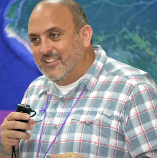
Organizations can benefit from geospatial technologies over a long term in multiple ways: When large State agencies open up their infrastructure, industries will grow around it and assure a longer-term offer. However, organizations must improve their operations with better information, and that is what we do with SERVIR-Amazonia. Finally organizations should communicate successes in order to exemplify the benefits.

Using geospatial with Amazon communities
The existence of geospatial information platforms has helped us in working with Amazon communities who sometimes have already taken the initiative to create their own information systems and taken leadership in monitoring their territories. However, education levels in science and technology are very low, for example, in the Peruvian Amazon, where the 12 year olds are very interested in technology but only around 3% have the basic knowledge to use them.
Indigenous Peoples perspective
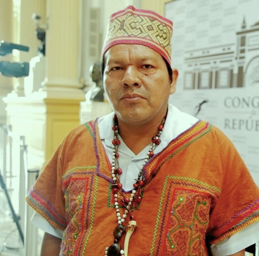
For an organization like FENAMAD, the use of geospatial information is very important. In order to use it at its full potential, monitor our territories and strengthen our communities, we need training, equipment and infrastructures. We are working with our partners like ACCA and SERVIR-Amazonia on all those fronts.
Gavin Schmidt
NASA Senior Climate Advisor and Director of the NASA Goddard Institute for Space Studies in New York

“The quality and breadth of data that NASA is bringing to the discussions on climate change can help us see what happens in the Amazonia where unique pressures are threatening a unique environment. However, all this data is not as easily accessible as it should be. There are too many data streams that are too often not integrated and not comparable with key socio-economic measures. Getting these resources in the hand of local stakeholders and decision-makers has to be a high priority for NASA and its partners. And that is where initiatives like SERVIR come into play: Networks that are plugged into local communities, and cross-agency partnerships can help coproduce the kind of products and services that none of us could do alone. I am tremendously excited to see the breadth of activities put together by the SERVIR-Amazonia Hub.”
Panel 2: Addressing Climate Change Challenges Together
 This second panel was moderated by Marina Piatto, Executive Director at Imaflora in Brazil, and discussed the decision-making aspects of geospatial technologies in the context of climate change.
Manuel Pulgar Vidal
Leader of Climate and Energy Global Practice WWF and former Minister of Environment of Peru
Marcela Quintero
Director, Multifunctional Landscape research area, Alliance Bioversity International and CIAT
Luis Felipe Duchicela
Senior Advisor for Indigenous Peoples’ Issues, USAID
Marion Adeney
Program Officer, Andes-Amazon, Moore Foundation

Geospatial technology to improve decision-making
In Peru 64% of emissions are due to land use, deforestation and land degradation. It shows that we need to address the source at the domestic level. International decisions are not enough, and technology can help us fulfill our own tasks and achieve our targets. And technology must fulfill three purposes: It must respond to threats, like illegal logging, mining, or fires. It must respond to the reality of the landscape, and it must help decision-makers to fulfil their obligations.
Get science-based evidence into use
To support decision-makers with climate change science and evidence, we scientists must make an effort to understand and meet the needs and objectives of local stakeholders. In our work we have to identify bottlenecks and help stakeholders find solutions for concrete actions by providing evidence that helps remove those bottlenecks. In a previous positive experience in Peru we were able to just do that, by helping the government remove obstacles that hindered the adoption of payment schemes for Ecosystem Services.
Recognition of indigenous people's rights
Indigenous peoples must take a lead role in the modern world to conserve critical ecosystems. We need to assure the commitment of national governments to take on board the rights of indigenous peoples in the Amazon, support them in strengthening their governance structure and improving their economies. Only if their rights, culture and cosmovision are recognized as a whole, can we start, from their perspective, to talk about marginalized groups´ rights.

From geospatial information to impact
To achieve results on the ground, we must recognize that information does not necessarily lead directly to impact. To bridge this gap, we need to design tools in collaboration with end users and with impact in mind – integrating across systems, stakeholders, and scales to make information actionable for communities and decision-makers. And, we need to think about how to measure the impact from the outset.
Jene Thomas
Mission Director of USAID/Peru

“Climate change is a top priority for the USAID government. The urgency for climate change adaptation and mitigation is now. No one is immune from the effects of climate change but it is the poor, disadvantaged and marginalized that are most vulnerable. At USAID Peru, we are partnering with local communities, indigenous peoples, women and youth to lead and sustain climate action.”
Discussion on independent versus State sponsored monitoring
In a final discussion round, Louis Verchot asked panelists to share their views on independent versus state sponsored monitoring. Panelists agreed that local monitoring is important, as it complements national efforts and provide more granular data. It helps communities improve management of local efforts.
Some further points were raised:
- State sponsored monitoring when it exists sets a baseline, but it is subject to political influence and budgetary issues. Independent monitoring is key for accountability and providing checks on these issues.
- There is a tension between providing multiple checks on a system and replicating efforts, which is to be seen as positive.
- Collective efforts with open source data and code (e.g. MapBiomas) produces quality data and governments have been using these data in their own monitoring efforts. However, comparability and interoperability are issues between different monitoring systems that limit usefulness
- For independent and community-based monitoring to work, capacity needs to be built continuously and its implementation has to be supported


