


By Kátia Fernandes, Assistant Professor of Geosciences, University of Arkansas
–> Visit the interactive mapping tool
Fires in the Amazon are the result of human activities that usually begin with deforestation to clear the land for the introduction of agro-pastoral activities. For most part, fires begin in non-forest parts of landscapes, but can escape to standing forest edges and burn the understory.
Predicting how intense the fire season will be is essential for prevention planning, but modeling fire activity as a function of climate requires several years of data. Fortunately, the satellite record of active fires has recently reached 20 years of continued measurements and models based on such information are becoming more robust with each year of added data.
Using sea surface temperature to forecast fires
One such forecast model (Fernandes et al., 2011) uses sea surface temperature forecast from as early as March to predict July-September fire season anomalies. Sea surface temperature is useful for prediction because ocean conditions couple with the atmosphere and drive large-scale atmospheric circulation patterns in remote regions. One such example is the El Niño Southern Oscillation, which consists of anomalies in sea surface temperature in the tropical Pacific but impacts the climate worldwide. Similarly, when the north tropical Atlantic is warmer than average, patterns of precipitation over South America shifts northward, reducing moisture inflow into the Amazon, creating drought conditions. Anomalously cool sea surface conditions do the opposite and push moisture south and into the Amazon, creating wetter conditions during the fire season.
The sea surface temperature index shown in Fig.1 is used as a predictor of fires in the July-September season. Looking back in time, the two major drought events of 2005 and 2010 in western Amazon occurred in years of very warm north tropical Atlantic with observed sea surface temperature anomalies of 0.48°C and 0.52°C, respectively.
Central and southern Peru, northern Bolivia and the Brazilian states of Acre and Rondônia expected to be most affected
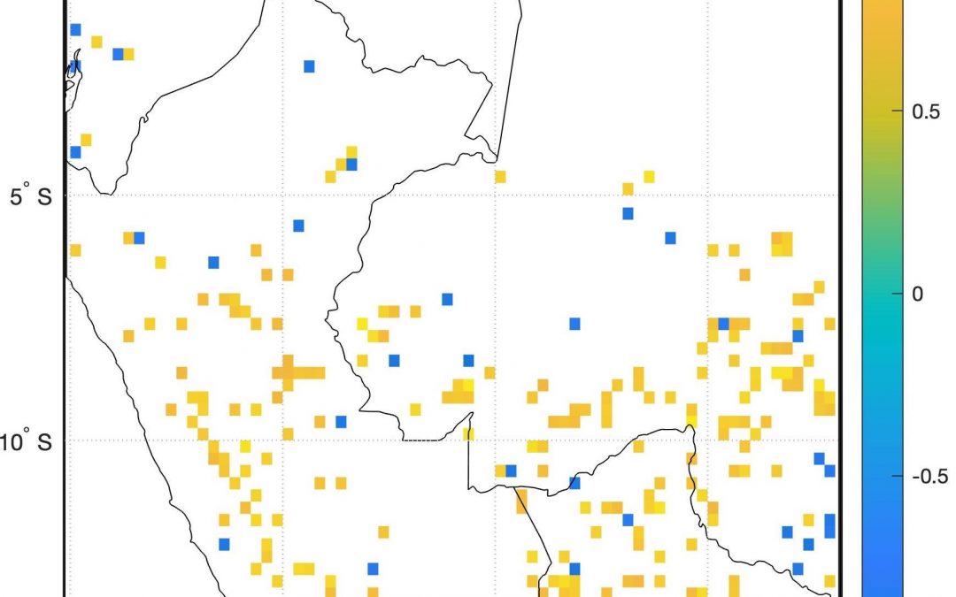
The July – September 2020 forecast points to an anomaly of similar magnitude of the 2005 and 2010 events (red bar in Fig.1). This suggests that the oceanic conditions are favorable to droughts during the upcoming July-September fire season in the Amazon. Positive values in Figure 2 indicate areas where we expect an anomalously active fire season in the coming months; negative values represent areas where we expect below normal fire activity.
Therefore, we expect an active fire season in most of the western Amazon – much of central and southern Peru, northern Bolivia and the Brazilian states of Acre and Rondônia. Notice there are some isolated negative (less active fire season) pixels in the map, but the results should be interpreted in terms of predominant behavior rather than individual values.
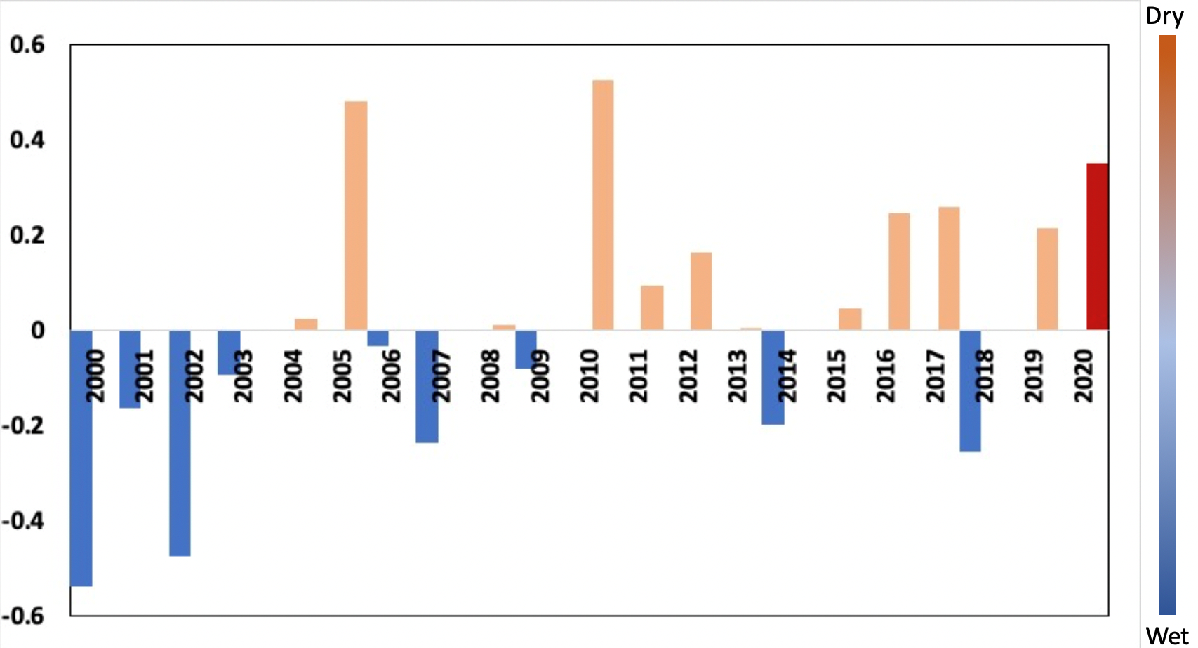
Fig. 1. July-September observed (2000-2019) north tropical Atlantic sea surface temperature anomalies (°C) and forecast for 2020. The bar on the right illustrates the typical dry season precipitation response related to Atlantic sea surface temperature anomalies.
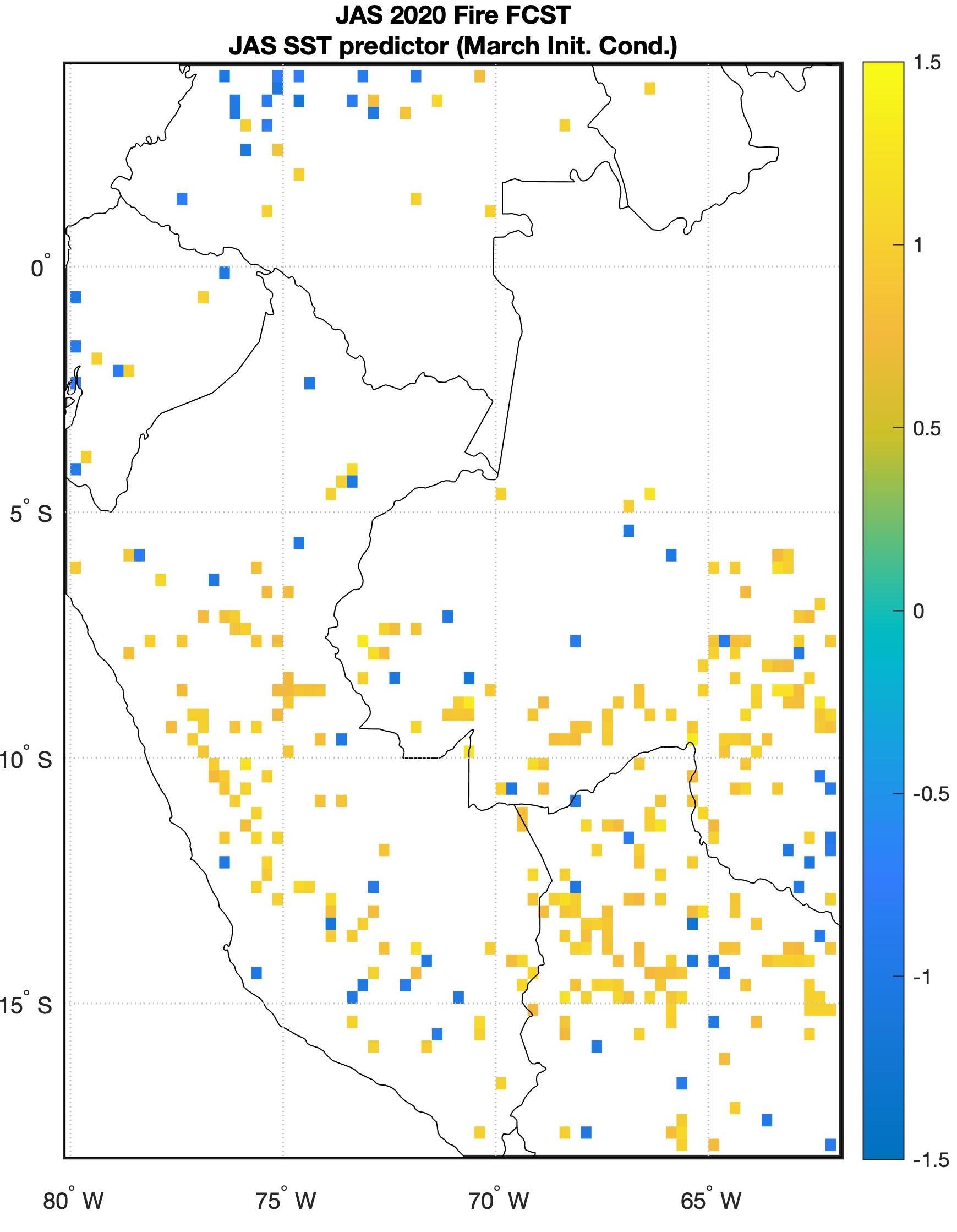
Figure 2. July-September 2020 fire anomalies seasonal forecast. Units of standard deviation.
Finally, the 2020 forecast based on the sea surface temperature index resembles the active fire season of 2010 (Fig.3) when the north tropical Atlantic registered the warmest anomalies of the last 20 years.
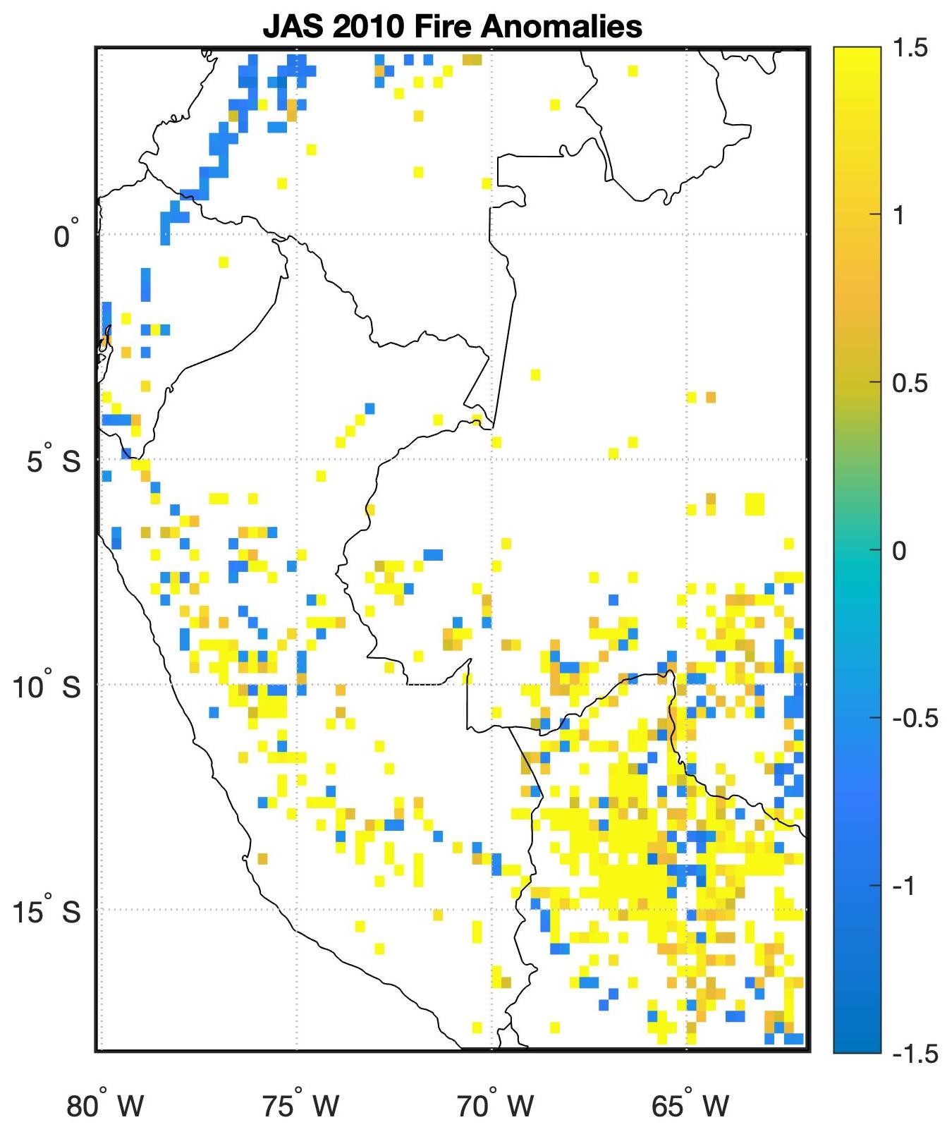
Figure 3. Observed fire anomalies in July-September 2010.
It’s important to keep in mind that climate determines only part of the variability of the fire season. In the absence of human activities, fires would be nonexistent in the Amazon, even in dry years, while a concentrated effort to burn will likely result in more fires than usual in years with normal precipitation leading up to the fire season, as it was the case in 2019. Nonetheless, assuming that land use practices are similar from year to year, unintended fire spread depends on whether the dry season is unusually dry or wet.
Improving the robustness of seasonal fire forecasting and monitoring
SERVIR-Amazonia is working at various fronts to improve the robustness of seasonal fire forecasting and monitoring, including a research effort by a NASA-Goddard led team. In addition, the forecast presented here is accessible through an interactive mapping tool linked to our SERVIR-Amazonia webpage. The mapping tool will be launched in April and it will allow the user to check the current July-September forecast and hindcasts (model predictions of previous years) with four initialization times (March, April, May and June). Moreover, SERVIR-Amazonia Hub partners are planning to distribute the forecast and gather feedback from stakeholders in the region. Online meetings are planned for the months of April and May to engage the main institutions involved in fire monitoring, prevention and mitigation in Peru and in Brazil.
Author of this Blog
 Kátia Fernandes
Assistant Professor of Geosciences
University of Arkansas