


The Caribbean nation finishes its first training program delivered by SERVIR-Amazonia.
In 2022, SERVIR-Amazonia began a training program on the use of geospatial tools in five Caribbean countries: Guyana, Suriname, Trinidad and Tobago, Dominican Republic, and Barbados, and the first country to successfully complete these training sessions is Trinidad and Tobago. SERVIR-Amazonia’s training objective is to improve these countries’ resilience to extreme weather events and to strengthen their ecosystem protection.
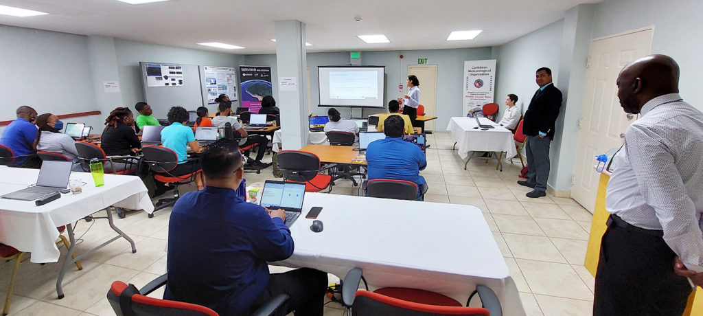
The twelve training sessions were held between January and April 2023. They were organized by SERVIR-Amazonia together with the Caribbean Meteorological Organization (CMO), to train representatives from government, academia, research, and non-governmental organizations in the island nation. The sessions were designed to develop programs on the use of geospatial tools to monitor hydrological events and to map mangroves and other ecosystems in the country in order to protect them.
Trinidad and Tobago initiated its Program in January and completed it successfully in May 2023. Photo: Caribbean Meteorological Organization (CMO).
The training was structured according to the findings of surveys and evaluations that had been conducted previously, which helped to understand the main tools used by each institution. They also revealed the institutions’ needs and limitations regarding the use of geospatial technologies, data, services, and the country’s technical capabilities. The surveys recommended improvements to increase the impact of mangrove monitoring and the management of hydrological events. Based on these results, specific topics were included within the training which included:
- Basic concepts about geographic information systems and their use with free, open-source software such as Quantum Geographic Information System (QGIS).
- The use and interpretation of moderate and high-resolution satellite imagery and synthetic aperture radar data.
- General knowledge of the Google Earth Engine platform.
- Methodological approaches for mapping mangroves and floods, and detecting changes in key areas using satellite images from different sensors.
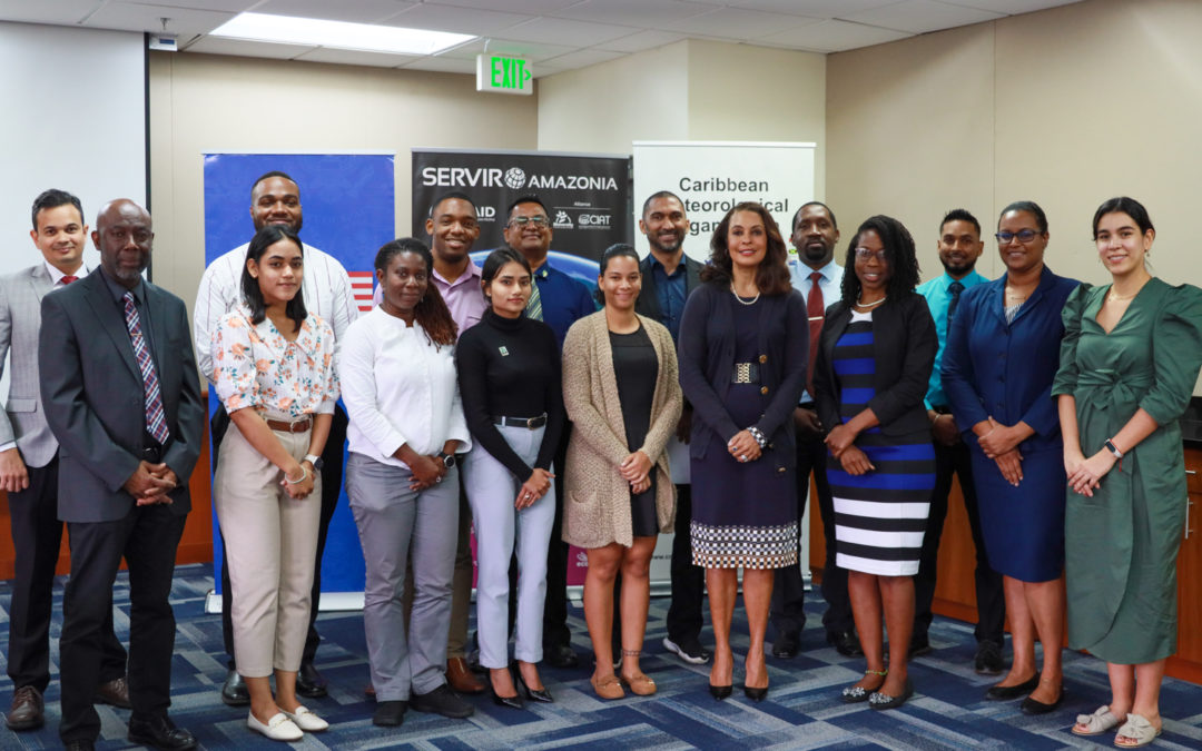
The training finished on April 27th with 23 certified participants from 11 of the country’s institutions including the Tobago Emergency Management Agency, the Division of Infrastructure, Quarries and Urban Development of the Tobago House of Assembly, the Office of Disaster Preparedness and Management, the Institute of Marine Affairs, the Ministry of Agriculture, Land and Fisheries, Environmental Management Authority, Trinidad and Tobago Meteorological Service, Water Resources Agency, Coastal Zone Management Unit, the University of the West Indies, and the University of Trinidad and Tobago.
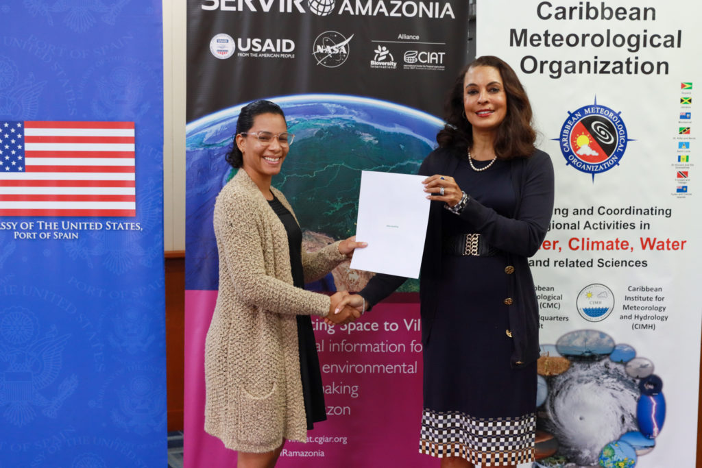
US Ambassador in Trinidad and Tobago Ms. Candace Bond attended the closing ceremony. Photo: USAID Trinidad and Tobago.
The closing ceremony was attended by Her Excellency, the United States Ambassador to Trinidad and Tobago, Candace Bond, who represented her country’s support for the SERVIR-Amazonia Program. Also in attendance were representatives of the Trinidad and Tobago Government and heads of different organizations that took part in the training program including Hayden Romano, Director General of the Environmental Management Authority; Allan Stewart, Director of the Tobago Emergency Management Agency; Arlene Aaron-Morrison, Assistant Director of the Trinidad and Tobago Meteorological Service; Rosemarie Kishore, Research Officer of the Institute of Marine Affairs; Kenneth Kerr, Science and Technology Officer of the Caribbean Meteorological Organization; and Ryan Assiu, Climate Finance Specialist from USAID.
Paula Paz, SERVIR-Amazonia’s Engagement Coordinator for the Caribbean, thanked all the partners that supported this event. She gave special thanks given to the Caribbean Meteorological Organization for loaning their facilities for the training and for their technical support, and to the Spatial Informatics Group (SIG) and NASA, whose expertise was used to develop the training’s technical tools and content.
Lastly, she congratulated those who took part in the training, and stressed “what the trainees have learned will not only serve them in their professional future but will also provide decision-makers in their country with more accurate and timely information to improve their warning and disaster prevention systems. If applied, their newfound knowledge could also contribute to the protection of the vital mangrove ecosystem that is key to the climate resilience of the islands, their coasts, and their local communities, which will help to protect Trinidad and Tobago from future environmental impacts”.
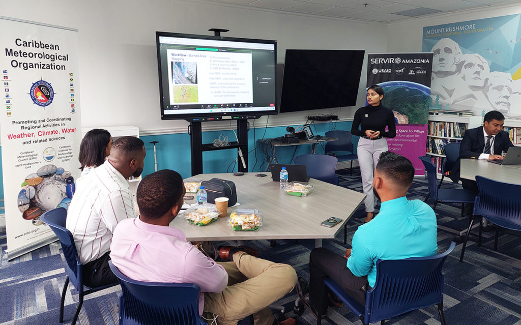
Trainees exchanged some views on how they will use what they learned throughout the Program. Photo: Caribbean Meteorological Organization (CMO).
As part of the closing session, the trainees exchanged opinions on what they had learned. They highlighted the collaboration that is needed to ensure the continuity of these initiatives, the applicability of open-source software and open data included within the training, and drew conclusions on how they plan to replicate what they have learned within their organizations and in other projects in the future. Through these interactions, the SERVIR-Amazonia Program (with the leadership of the Alliance of Bioversity International and the International Center for Tropical Agriculture – CIAT) and its partners, hopes to have opened up the possibility for further opportunities to develop climate resilience and a sustainable future for Trinidad and Tobago.