


The National Aeronautics and Space Administration (NASA) has launched four new Applied Science Teams (AST) projects that the SERVIR-Amazonia Program will support over the course of 2023 to complement its conservation and climate change mitigation work in the Amazon basin.
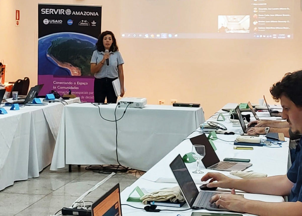
To kick start this joint collaboration, SERVIR-Amazonia held a meeting in Piracicaba, Brazil, in April of this year with the projects’ scientific teams, attended by more than 25 professionals from the Program and its stakeholders.
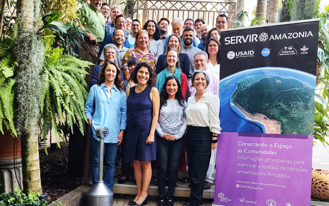
The 3-day meeting gathered 25 representatives from NASA, USAID, Alliance Bioversity & CIAT, SERVIR-Amazonia local partners (ACCA, Fundación, EcoCiencia, Imaflora), University of Arkansas and Spatial Informatics Group – GIS. Photo: Imaflora.
These teams, like the previous ASTs (designed to bring U.S.-based scientists closer to experts in Asia, Africa, and the Americas), will be responsible for transferring knowledge and skills about technologies developed from Earth observations to government agencies, NGOs, and other organizations involved in environmental conservation that contribute to the progress and sustainable use of natural resources in the Amazon region.
The teams and their projects:
Monitoring forest carbon dynamics in response to disturbances in the southwestern Amazon. Principal investigator: Izaya Numata, University of South Dakota.
In response to ecological disturbances (or events that drastically impact an ecosystem) occurring in the Amazon, such as deforestation, forest fragmentation, fires, and droughts, this project will develop a tool to monitor carbon changes in Brazil and Peru. It will generate current and historical forest biomass data using remote sensors that allow the design of 3D forest maps with Lidar technology from the Global Ecosystem Dynamics Investigation (GEDI).
Numata explained that “although SERVIR-Amazonia has the capacity to monitor forest change such as deforestation, degradation and regeneration in the Amazon region, it lacks data that indicates changes in forest biomass or carbon, and we propose to develop this missing capacity”. This will “improve forest management and efforts to conserve natural resources and biodiversity”.
Partner agencies that will assist with the joint scientific and social development of the service are the Federal University of Acre in Brazil and Conservación Amazónica – ACCA in Peru.
Subseasonal-to-seasonal forecast of hydro-ecological extremes in the Amazon basin. Principal investigator: Benjamin Zaitchik, Johns Hopkins University.
Through a sub-seasonal forecasting and early warning model, this project will aim to integrate hydroecological forecasts with existing and new climate services for drought, fire risk, flood potential, flow conditions, and their associated impacts on the Brazilian and Peruvian Amazon.
According to Zaitchik, “this kind of forecast still isn’t widely used in real-world applications and it will be innovative in that we will be co-designing the forecast targets with our partners so that the forecasting effort itself is tailored to prediction targets that are meaningful for the end-user. We won’t just make a standard forecast and expect the user to figure out what it means”. Thus, the great advantage of this service will be the flexibility to customize the system according to the needs of the agencies using it.
National agencies implementing the project include: the National Center for Monitoring and Alerting of Natural Disasters of the Brazilian Ministry of Science, Technology, and Innovation (CEMADEN-MCTI); in Peru, the National Meteorology and Hydrology Service (SENAMHI); and in Ecuador, the National Institute of Meteorology and Hydrology (INAMHI).
Unlocking the power of NISAR for mapping the Amazon’s forest-agriculture interface. Principal investigator: Naiara Pinto, NASA Jet Propulsion Laboratory (JPL)
This project will map palm oil production as well as cocoa monoculture production at sub-national scale in Peru and Brazil, and verify how the livelihoods of local communities can be improved while counteracting deforestation. Accurate monitoring of these production systems using radar data from NASA’s NISAR project would encourage cultivation on already degraded lands. It would also improve management practices to increase productivity and transparency in the supply chain. Both actions will contribute to integrating farmers into the market with zero deforestation certifications.
Partner agencies for this service include the Brazilian Agricultural Research Corporation of the Ministry of Agriculture and Livestock (EMBRAPA-MAPA), the Ministry of Agricultural Development and Irrigation, Peru (MIDAGRI), the Peru Cocoa Alliance, and the Regional Government of Ucayali, Peru.
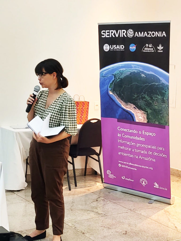
NASA’s Jet Propulsion Laboratory (JPL) Naiara Pinto presented her project, as did Izaya Numata, Benjamin Zaitchik, and Michael Keller. The four researchers gave a brief introduction to their research during the meeting. Photo: Imaflora.
Quantifying forest carbon stock changes in the state of Mato Grosso, Brazil. Principal investigator: Michael Keller, International Institute of Tropical Forestry (ITTF) of the United States Department of Agriculture (USDA).
The service will assess changes in carbon stocks associated with land use activities, forest disturbance, and regeneration, and “allow Mato Grosso to engage with carbon markets with high-quality data with well-quantified uncertainties”, to mitigate greenhouse gas emissions.
This team will concentrate on the Brazilian state of Mato Grosso because, according to Keller, “it has been a focus of forest change for over 40 years”, but also because “the government and civil society are eager to engage in international carbon markets”. The project will aim to deliver a service that quantifies losses and gains of forest carbon stocks in that region, based on satellite remote sensing data.
The local partner institution is the Secretariat for the Environment of the State of Mato Grosso (SEMA-MT), Brazil.