


Geospatial capacity building is at the root of SERVIR’s mission. Strengthening the capacities in the region leverages our strategic approaches, namely, building strong partnerships to co-develop geospatial services and working with stakeholders in the use of those services to improve environmental decision-making.
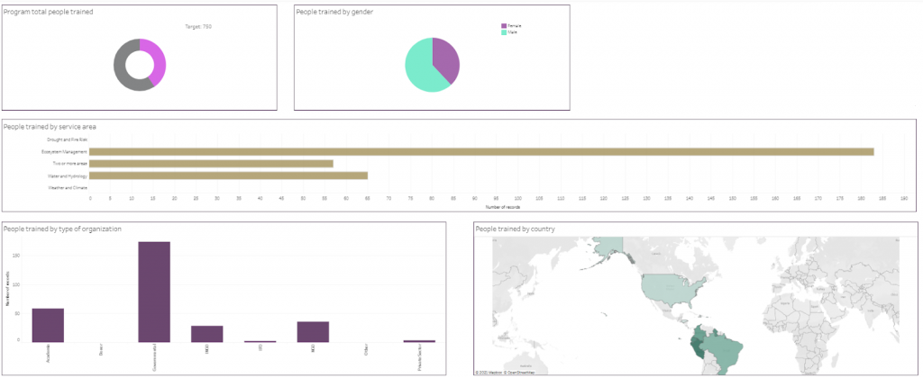
Screenshot of the Monitoring dashboard accessible from the SERVIR-Amazonia Website
Overview of year 2 training activities
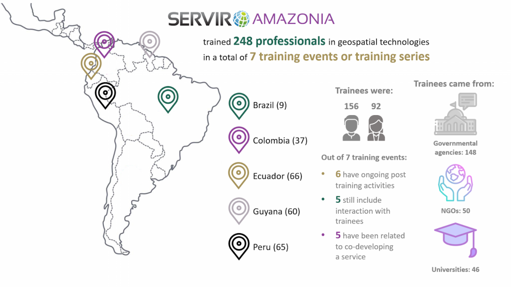
During the second year of Program implementation (October 2019 to September 2020), SERVIR-Amazonia trained 248 SIG professionals (92 female and 156 male) in geospatial technologies during a total of 7 training events or series (repetition of the same training in different countries in the region). 148 trainees came from governmental agencies, 50 from national and international NGOs, and 46 from universities, all from five of the six target countries: Ecuador (66), Peru (65), Colombia (37), Brazil (9), and Guyana (60). See the Monitoring dashboard for more information.
Trainers were members of the Program team, Subject Matter Experts from NASA, Applied Science Teams, and the Hub partner institutions: Spatial Informatics Group (SIG), Alliance Bioversity-CIAT and Conservación Amazónica-ACCA.
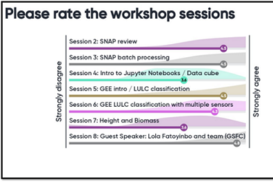
Satisfied trainees
The Monitoring, Evolution and Learning team of SERVIR-Amazonia analyzed the effects of the training activities immediately after the events through a standard online survey applied by trainers in which participants are asked to rate on a 5-point scale the workshop objectives, different training aspects and what they perceive to be applicable to their work.
“On a 5 point scale, average ratings for year 2 training events are over 4.0 with high marks for usefulness and applicability.”
Results
Together with the trainers, we have been looking at what happened since those seven training workshops were held. Six have led to post-training activities, and trainers from five events still interact directly with trainees. Most importantly, five training events were related to geospatial information service developments or led to the development of a service. Memorandums of Understanding (MoU) have been signed with 4 of the main partners of those training events, SENAMHI, CONGOPE, MINAM and NAREI. With two more, the Program is finalizing MoUs and related work plans.
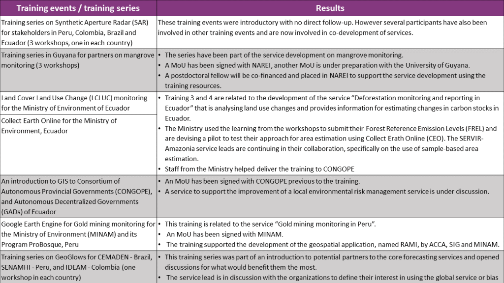
Seven training events, contexts and results
Next steps
For this third year of Program implementation, 32 service-related training events are planned by the leaders of the 11 services that are currently under development with partners. We expect to train 150 people, and provide access to 20 training resources on the Program Library.
Capacity building during the third year will have to go beyond service development. Our efforts will now be addressing also service delivery to reach the decision-makers in the organizations that we work with and their stakeholders. The SERVIR Amazonia Program will thus continue to share knowledge and create awareness about the potential of geospatial information systems and technologies to support informed environmental decision making in the Amazon region.
Author of this blog post
 Simone Staiger-Rivas
Coordinator: Monitoring-Evaluation-Learning, Communications, Knowledge Management