Brazil is one of the six countries of the Amazon basin covered by SERVIR-Amazonia, including Colombia, Peru, Guyana, Ecuador, Suriname.
Needs-based services
In line with its service co-development approach, SERVIR-Amazonia is bringing diverse Brazilian stakeholders together to identify local development problems and identify solutions in form of tools, data sets, training resources and capacity building activities that use satellite data, Earth science, and geospatial technologies. Promoting collaboration among a range of stakeholders from governments, universities, local partners, and U.S. scientists, the ultimate goal is to improve local capacity to harness satellite data and geospatial information to foster sustainable natural resource management.
First partnerships to co-design climate-smart solutions
Currently in its third year of implementation, SERVIR-Amazonia has engaged with more than 30 Brazilian institutions and organizations. Collaboration has been recently formalized with the Environmental State Secretariat – SEMA-Acre and the Brazilian Agricultural Research Corporation – Embrapa.

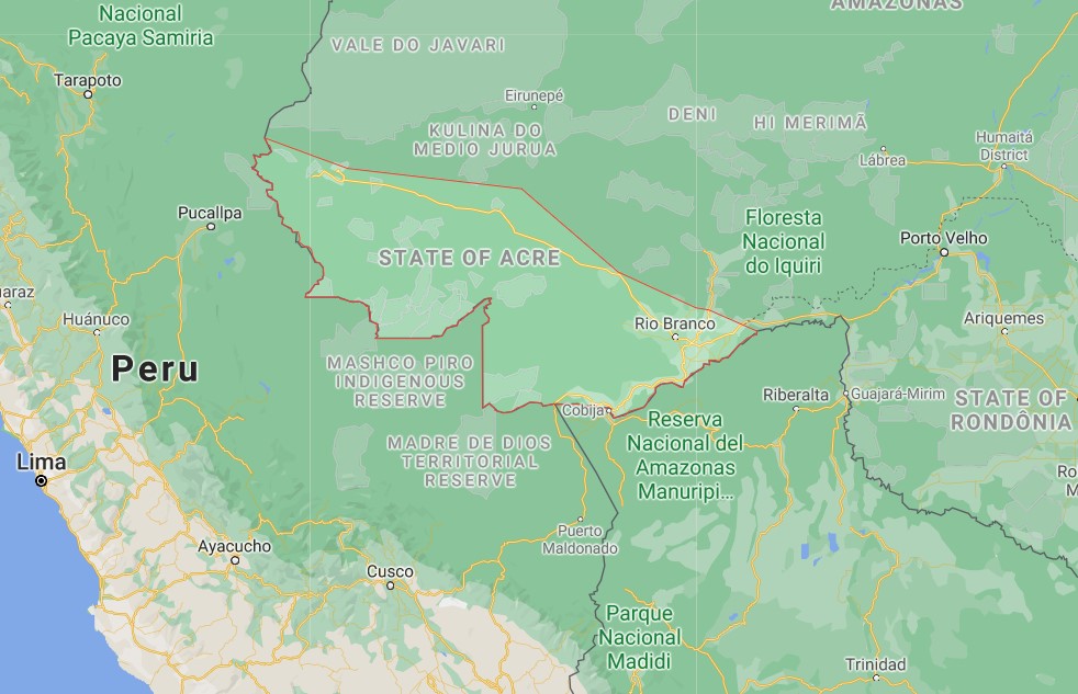
Map: The State of Acre in Brazil with the Peruvian border
The collaboration with SEMA-Acre aims at reducing environmental, economic and social impacts of climate-sensitive issues related to fire and drought events, as well as to land use changes in the State that could affect ecosystem services and biodiversity. At the peak of the fire season in August 2020, Acre has had as many as 1,300 deforestation-associated fires, 840 agricultural fires, 200 grassland fires, and 25 understory fires in a single day. It is estimated that Acre also lost more than 84,000 hectares of forest cover in 2019. This has contributed to an annual average of 35.9 million tons of CO2 released into the atmosphere due to deforestation and fires (Source: SEMA-Acre).
The use of new technologies, such as Collect Earth Online (CEO), will advance the State capacity to estimate areas of deforestation, and degradation. CEO provides an easy to use platform for visual classification, area estimation, and accuracy assessment for land use and land cover change mapping and statistics. CEO now includes the very high resolution monthly mosaics of the world´s tropics provided by Norway’s International Climate & Forests Initiative (NICFI) that will provide greater ability for the state of Acre to detect forest cover loss and change at a high cadence for the reduction of emission from deforestation and forest degradation.
The collaboration will involve women and indigenous communities in the service design and field validation processes, such as the Acre Pro-Indigenous People Commission (CPI-Acre) as well as organizations that produce science and promote its extension, such as the Federal University of Acre, UFAC.

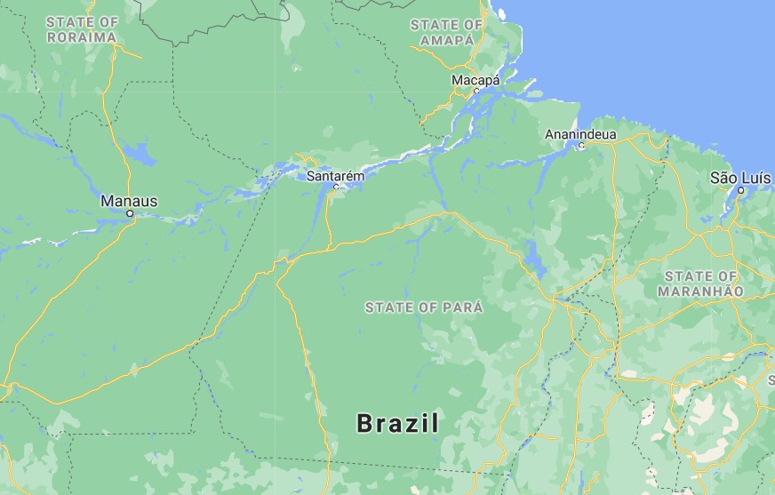
Map: State of Pará in Brazil
In the case of Embrapa, the collaboration will focus on Ecosystem Services Modeling in The Amazon’s Forest-Agricultural Interface in the state of Pará: This service provides accurate maps for stakeholders and decision-makers to understand the policy and economic scenarios that tip agricultural production systems towards deforestation, particularly due to palm oil and cocoa production. The use of satellite imagery and active sensors, coupled with field validation will reveal land cover patterns and lead to the generation of accurate plantation maps of cocoa, palm fruit, acai berry and citrus fruits, to allow stakeholders to understand crop expansion over deforested areas in different regions from Pará.
The state is one of the largest producers of cocoa, palm oil and acai in Brazil. In 2019, according to data from the IBGE (Brazilian Institute of Geography and Statistics), the state produced 2 million 543 thousand tons of palm oil bunches, 129 thousand tons of cocoa beans and 1 million and 400 thousand tons of acai fruits. Regarding national production, the state is responsible for 98% of palm oil, 49% of cocoa and 95% of acai produced in the country.
Geospatial services under co-development in Brazil that address climate change adaptation and mitigation
Beyond those two partnerships, SERVIR-Amazonia has started discussions with other partners, such as CEMADEN (Brazilian Centre for Monitoring and Early Warnings of Natural Disasters) and CENSIPAM (Amazon Protection System Management and Operational Center), in view of collaborating on the following services:
With CEMADEN, SERVIR-Amazonia plans to co-develop a service which aims to Improve Resilience and Reduce Risk of Extreme Hydrological Events. This service provides stakeholders in the Amazon basin region with an improved flood forecasting ability, including more accurate information about timing, magnitude and impact, to increase their understanding of risks and support greater resiliency to flood disasters. Read more.

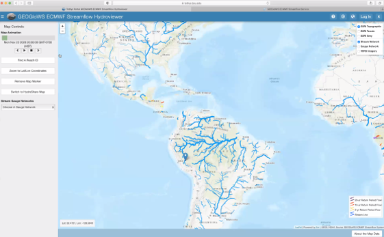
SERVIR-Amazonia works with the NASA Applied Science Team from Brigham Young University’s Hydroinformatics Lab
in the development of water-modeling software that provides a user-driven solution to the lack of streamflow forecasting information in the Amazon.
Likewise, with CENSIPAM, SERVIR-Amazonia is discussing the co-development of a service to provide Forecasting Seasonal to Sub-Seasonal Fire and Agricultural Risk from Drought: This service provides information for reducing the negative impacts of drought and fire on forest and agriculture in the Amazon basin, evaluating drought conditions at temporal and spatial resolution to predict fire vulnerability. Read more
More geospatial services that address climate change mitigation and are under development in Brazil
- TerraOnTrack (Increase the Protection of Forests managed by community-based initiatives in the Brazilian Amazon): The service is a web application that will contribute to community-based initiatives by introducing resources that will allow traditional communities and indigenous people to quickly monitor their territories and activities on the ground, which in turn will increase forest protection and territorial management capacity.
- Quantifying the Effects of Forest Changes on Provisioning and Regulating Ecosystem Services. The service allows regional and local planners and decision-makers, as well as citizens of Acre and Ucayali (including the indigenous and traditional communities of the Sierra del Divisor, Yurua, and Purus watersheds) to better understand the tradeoffs between development activities and ecosystem services. Read more
- TerraBio (Monitoring forest dynamics from space to enable sustainable livelihoods and biodiversity conservation in the Amazon). The service introduces a monitoring tool to assess the impact of private sector engagement on biodiversity conservation in the Amazon by characterizing forest and habitat dynamics. Read more


